Balancing Connectivity and Conservation in the Iquitos–Saramiriza Road Plan
Proposed to link Iquitos with Peru’s northern coast, the Iquitos–Saramiriza road raises complex trade-offs between regional integration, forest conservation, and Indigenous territorial rights.
Balancing Connectivity and Conservation in the Iquitos–Saramiriza Road Plan
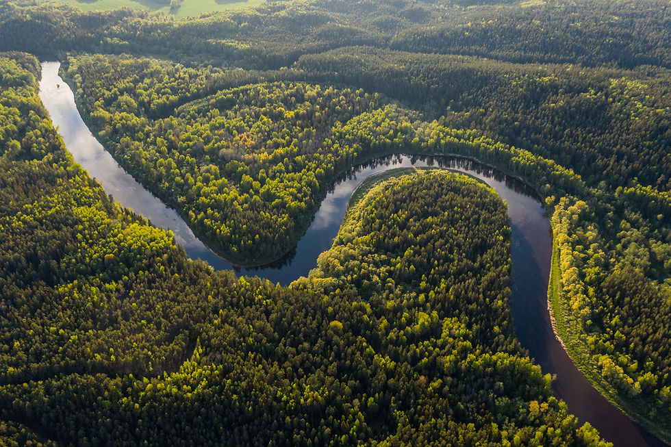
The Iquitos–Saramiriza road project seeks to overcome Loreto’s longstanding isolation by creating a 710-km land connection between Iquitos and the northern coast. Although legally declared of national interest in 2017, the project remains in pre-investment studies. Several environmental assessments warn of significant long-term risks.
According to scientific analyses, road construction could trigger the loss of 1,128 to 3,200 km² of forest over 20–30 years, affecting carbon-rich ecosystems and releasing substantial greenhouse gas emissions. Studies cited in the project documentation note that 3,961 plant species and 1,595 vertebrate species lie within the potential impact area. Impacts on water bodies could also harm aquatic life and river-dependent communities.
Social risks are considerable: the most likely road alignment would intersect territories of up to 19 Indigenous communities, threatening cultural practices, land security, and health due to altered water sources. Workshops led by WCS and ORPIO reveal fears regarding deforestation, territorial invasion, rising crime, and pressures from extractive industries. While the project could improve market access and basic services, its early-stage status offers a crucial opportunity to assess alternatives, such as enhanced river transport, and to incorporate meaningful consultation and transparency before any construction begins.
This case was developed by Sinfranova in collaboration with The Nature Conservancy Peru in 2022 and published in 2025.
To read the full case in Spanish, click here: